Fortifications in the Province of Quebec: a Part of the Region’s Archaeological Heritage
par Santerre, Simon
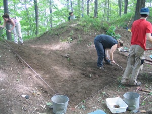
Modern-day Quebec is dotted with forts and the remains of old fortifications, traces of a military history dating all the way back to the days of New France. These installations, which were once inextricably linked with the political and socio-economic realities of the colony, are now a window to the past. With the purpose of situation the various discoveries made at these sites within the appropriate historical framework, archaeologists have delved into the history of these once lost vestiges. As a result, is it now possible to not only trace the work of the military engineers and trades people that designed them and to establish their role in the military strategies of the day, but also to determine the state of the colony at a given point in history.
Article disponible en français : Fortifications au Québec, un patrimoine archéologique
The Archaeology of Fortifications in Quebec
Quebec's fortifications were all part of major strategies aimed at defending the colony's ever-changing borders, be it in the days of New France, Lower Canada or the Province of Quebec. Of course, the network of fortifications extended beyond the province's current borders. With discoveries of varying magnitude made at more than twenty sites, the study of fortifications is a particularly thriving branch of archaeology in Quebec.
A dozen sites show the evolution of the defence network under the French Regime from the founding of Quebec City to the outbreak of the Seven Years War [which most Americans know as the French and Indian War]. Among them, the fortifications in Quebec City - from the earliest walls around the city to the fortifications built in 1745 - stand out as having provided the most information regarding the evolution of these installations.
Montreal was also a walled city once. As a number of archaeological discoveries have shown that the city's earliest fortifications consisted of wooden piles, which were eventually replaced by masonry walls. La Prairie, in the Montreal region, is undoubtedly one the best documented (archaeologically-speaking) walled cities in Quebec. In the Richelieu River Valley, an area considered to be the main avenue for troops attacking from the British colonies and Iroquois territories, various archaeological studies have been carried out at forts Saint-Jean, Chambly and Sainte-Thérèse. The city of Trois-Rivières was surrounded by a bastioned wall from 1651 to 1752, but very few traces of it have been found to date.
The Seven Years War, which caused a boom in the construction of fortifications in North America, is represented in Quebec by four sites (or groups of sites), as well as by the aforementioned installations, which were also put to use during the war. Fort Jacques-Cartier (Cap-Santé), Fort Lennox (Île au Noix) and Fort Lévis (Chimney Island, Ogdensburg, NY; formerly known as Île Royale (NOTE1), were all built in the year following the end of the 1758 campaign. At the same time, an imposing series of fortifications was built in Quebec City, from a bridge head at the mouth of the Saint-Charles River to redoubts and batteries extending as far as Beauport. Despite a number of archaeological surveys at various sites, nothing probative has been discovered about these fortifications as of yet.
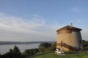
Following the war, the British examined the state of their defences. Some fortifications were deemed essential, while others were simply abandoned. Six sites date back to this era and Quebec City was once again among the most important to be considered. The city's fortifications were bolstered by the addition of a citadel and Martello towers and changes were made to certain sections of its ramparts. A short time later, three forts were built across the St. Lawrence River, on the Pointe de Lévy. Fort number 1 is currently open to the general public.
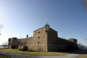
A fort on Montreal's Île Sainte-Hélène has also been the subject of several archaeological surveys. The storage facilities and fortified barracks uncovered at the site are evidence of the city's role as a key supply point on the St. Lawrence in the 19thcentury. A number of archaeological studies have also been carried out at Fort Lennox, which still stands today on Île au Noix, in the Richelieu River Valley. The discoveries made there mainly concern the evolution of the fort's architecture, but they have also revealed information about certain elements of the first fortifications built on the island by the British between 1776 and 1819.
In 1812, an irregular fortification was built in Coteau-du-lac to defend access to a canal. The fort, which was used until 1856, underwent three archaeological digs in the 1960s. It is now key evidence of 19th-century military defence strategies, which were based around establishing connections between Montreal and Kingston via a series of canals dug to circumvent the rapids along the way.
Towards the mid-19th century, as Canada and the U.S. jockeyed over a stretch of border south of Témiscouata, four forts were built to protect the portage between Quebec City and Halifax. Two of them - Fort Dégelis and Fort Ingall - were located in Quebec. Fort Ingall has been the subject of five seasons worth of archaeological digs and its reconstruction is now open to the general public. Fort Dégelis, on the other hand, has only been the subject of a few small-scale digs, which failed to unearth any conclusive evidence.
The Evolution of Fortification
These archaeological discoveries make it possible to tie a site not only to a time in the history of fortifications in Quebec, but also to Canada's socio-political, economic and military history. First and foremost, these forts were defensive military installations; such installations were meant to protect key strategic locations and the methods used to repel attacks depended on the location and its importance.
Theories imported from overseas contributed to the evolution of North American techniques of fortification, as did unstable diplomatic relations and the resulting geopolitical changes. For example, the pile walls that were widely used in the 17th-century wars between the French and Iroquois were insufficient protection against the English; stronger walls, usually made of earth and sometimes covered with masonry, were needed in order to withstand sieges and artillery fire. Later, during the Seven years War, temporary fortifications designed to serve very specific functions over a short period of time were built in a more rudimentary fashion than their permanent counterparts.
Under British rule, especially following the American Revolution, the newly-traced border and the development of an increasingly-reliable network of land routes (which made it easy to simply go around the forts) forced colonial authorities to adopt a different defence strategy. As a result, the forts were used to store supplies and equipment along land and sea routes, while a number of smaller installations, usually blockhouses, served as relay stations and defended these same routes.
Following the advent of railways and smooth-bore artillery in the late 19th century, bastioned fortifications were replaced by detached forts. The signing of the Treaty of Washington eventually put an end to the conflict between Canada and the U.S. and foreshadowed the retreat of British troops, effectively ending the colonial period. (NOTE2) It also marked the end of the classical period of fortification inCanada.
Promoting the Heritage Value of Quebec Fortifications
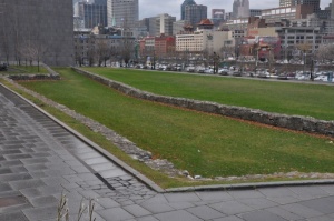
Preserving and promoting the forts is no simple task. Many questions have arisen. For example, does the archaeological restoration and preservation of the forts make it possible to offer an accurate representation of the developments in fortification techniques during the colonial period? Do the sites that are now open to the general population show the evolution of the network of fortifications in the context of various defence strategies? Of the afore mentioned sites, about a dozen are now open to the public and offer a number of ways of better appreciating and understanding archaeological discoveries - interpretation centres, interpretive panels, commemorative plaques, in situ interpretative lines and landscaping representing archaeological vestiges, guided tours and brochures. Some sites, such as the fortifications in Quebec City, were occupied for an extended period of time and thus show the evolution of fortification throughout the French and British regimes. Others, which were in use for much shorter periods of time, represent a particular type of fortification. Such is the case of Fort Lennox, built when bastioned walls were still in vogue, but at a time when theories regarding detached forts had begun to emerge, making it one of the last bastioned forts built in North America. The forts on the Pointe de Lévy, on the other hand, are unique examples of late-19th-century detached forts.
While it is relatively easy to identify a fort's various architectural components by its vestiges, framework and iconography, it is more difficult to pinpoint the role played by this same fort in one or more defence strategies over the years. A sizeable communication effort is required to identify the various wars and socio-political contexts that led to the elaboration of a particular strategy.
Quebec's fortifications boast a rich archaeological heritage, but only a fraction of them are open to the public and those that are do not always do justice to major trends in fortification or to their architecture and the networks they formed at various periods throughout history. It is therefore very important to continue relying on the individual forts and their vestiges, in hopes of combining them into a site development and interpretation network that would increase our understanding of the colony's various defence systems. Since a lot of work remains to be done and promoting archaeological heritage is often a costly business, the creativity of all those involved (whether currently or in the future) will be in heavy demand
Simon Santerre
Archaeologist
NOTES
Note 1: Île Royale (Chimney Island) was partially destroyed during construction of the St. Lawrence Seaway. Fort Lévis either sank or was destroyed before being any archaeological surveys could be carried out at the site.
Note 2: Desloges, Yvon, Les forts de la pointe Lévys, Archaeological, architectural and historical study, National Historic Sites, Environment Canada Parks Service, Ottawa, 1991, page 65.
BIBLIOGRAPHY
Beaudet, Pierre and Céline Cloutier, Les témoins archéologiques du fort Chambly, Ottawa, Environment Canada Parks Service, 1989, 125 p.
Bélidor, Bernard Forest de, Dictionnaire portatif de l'ingénieur, Paris: Charles-Antoine Jombert, 1755, 339 p.
Charbonneau, André, Les fortifications de l'Île aux Noix, Reflet de la stratégie défensive sur la frontière du Haut-Richelieu aux XVIIIe et XIXe siècles, [n.p.] Canadian Heritage, Parks Canada, Canada Communication Group, éd. Du Méridien, 1994, 390 p.
Charbonneau, André, Yvon Desloges et Marc Lafrance, Québec, ville fortifiée, du 17e au 19e siècle, Ottawa: Parks Canada, 1982, 491 p.
Desloges, Yvon, Les forts de la pointe Lévys, Archaeological, architectural and historical study, National Historic Sites, Environment Canada Parks Service, Ottawa, 1991,73 p.
Hogg, Ian, Fortifications : histoire mondiale de l'architecture militaire, Paris, Atlas, 1983, 256 p.
Lambert, Phyllis and Alan Stewart, (sous la direction de) Montréal, ville fortifiée au XVIIIe siècle, Montréal, Canadian Centre for Architecture, 1992, 93 p.
Santerre, Simon, Le patrimoine archéologique des fortifications au Québec, Inventaire des sites archéologiques du Québec, Québec, Ministère de la Culture des Communications et de la Condition féminine, 154 p. Available online [French only] from the Ministère de la Culture, des Communications et de la Condition Féminine du Québec: http://www.mcccf.gouv.qc.ca/index

